
 1 month ago

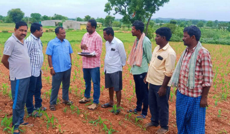
Siddipet: The State government is carrying out a digital crop survey across 17 districts in Telangana, as part of which Agriculture Extension Officers in one mandal in each of these districts will photograph all the crops sown in their respective mandals in different directions.
The AEOs will upload 20,000 to 30,000 pictures from each of these mandals covering all the fields. While the State government has selected Narayanraopet mandal in Siddipet district, it selected Kondapur mandal in Sangareddy district for the digital survey.
Agriculture department officials said the government was on the job to create a single and verified source of the data on crop sown areas in the State. It will be useful for accurate crop area estimation and making several farm-centric policies and solutions in the days to come.
Meanwhile, the government was also planning to take up satellite surveys of crops after the completion of these digital surveys across these 17 mandals.
The artificial intelligence technology used by the State government will recognise the crops based on the photographs already uploaded by the agriculture officials after the satellites capture the pictures on the ground during both seasons every year.
A similar survey was carried out during the Vanakalam period too in the same 17 mandals. The photographs of Vanakalam crops were also uploaded then.
Since the farmers would cultivate different crops during Yasangi and Vanakalam, the agriculture department had carried out separate surveys during Vanakalam and Yasangi.
The officials said that the satellite could not differentiate the crops that were closely similar like Jowar-Maiz and Green Gram-Black gram. When agriculture officials upload these pictures into the database, that would help the satellite identify the crop’s sown area accurately.
The survey was launched in February, they have completed more than 90 per cent of their job so far. Once they create enough databases, the government will carry out only satellite-based surveys putting a full stop to age-old manual surveys.


 English (US) ·